For one of my PhD case studies I'm currently building a small body of aerial photography work around some of the hillforts in my local area. As well as kite aerial photography I have also approached these sites from a light aircraft for higher altitude views. Here are some of the resulting images from a recent flight over Angus, Perthshire and Fife, Scotland.
 |
| White Caterthun (front) with Brown Caterthun hillfort in the distant left |
This was a chance to return to some of the sites which I photographed back in March under snow cover, including the impressive White and Brown Caterthuns (above) near the town of Brechin. After much waiting for the right weather conditions we were finally treated to a clear afternoon with some fantastic low Autumn light.
 |
| Barry Hill hillfort near the town of Alyth, Angus, Scotland |
While we lingered at some sites, others where shot in passing like Barry Hill (above). With hillforts dotted across the landscape it was easy to plan a route which included a good number. A return to Turin (below) was also only a slight D tour as we left the Caterthuns.
 |
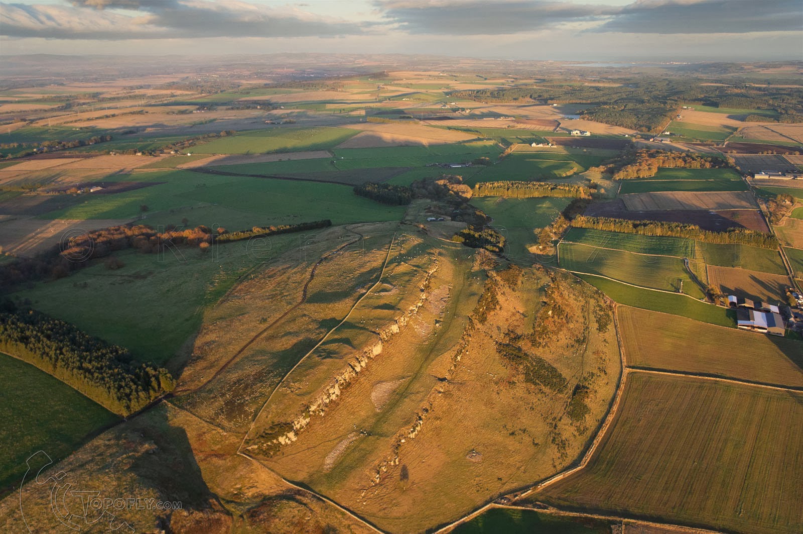
| Turin Hillfort is made up of a number of enclosures above a rocky outcrop. |
I've found it difficult to photograph from higher altitude and still situate these sites within their landscape context. The distance from the ground and obstructions shooting from a high wing aircraft mean that the tendency is to use strong lenses which can crop out the background and leave a site in isolation. To get parts of the aircraft out of the picture requires a bit of negotiation with a skilled pilot!
 |
| Castle Law near Forgandenny with the Tay Estuary behind |
Photographing from high up has a totally different dynamic from the kind of wide-angle low-level kite aerial photography that I'm more used to. I'm particularly interested in how the high-level view can be used to juxtapose elements of the landscape which would otherwise be reduced from the kite's perspective. The shot below of East Lomond hillfort with the town of Falkland behind is an example of this - an almost forced perspective that brings the background forward.
 |
| Evening light shows up the ramparts at East Lomond hillfort. |
These images will form part of a resource to inform animated computer-generated outcomes over the coming months. One of the aims of this project is to show these fantastic sites in a way which incorporates the wider landscape that they form part of. During these flights a lot of data is generated very quickly so the immediate task is to continue a lengthy sorting process!